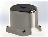
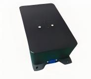
Introduction
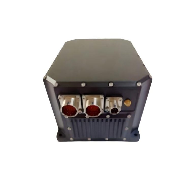
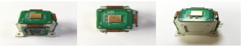
This MEMS Integrated INS has a built-in full temperature of 0.5°/h high-precision MEMS gyroscope, a 100ug high-precision quartz accelerometer and a survey-level GNSS receiver of multi-mode and multi-frequency for dynamic fast alignment or GNSS dual antenna support fast and high precision orientation up to 0.1°. The product supports GNSS/odometer/DVL/barometric altimeter and other sensors external, with excellent scalability. Through the use of multi-sensor data fusion technology, to combine inertial measurement and phase together, it can make the system have geographical adaptability and robustness greatly improved. The product can meet the application requirements of marine surveying and mapping and map surveying and mapping, matching the original data storage, the level of surveying and mapping, and the post-processing software for surveying and mapping navigation. Users can match according to their needs.
Features
High Precision MEMS Devices: 0.5°/hr gyroscope, 100ug accelerometer
Survey level GNSS receiver: support GPS/BDS/GLONASS
Dynamic fast alignment: support fast alignment, 1-2 minutes (need to be dynamic maneuver)
Dual antenna fast orientation: supports dual antenna fast assisted orientation: accuracy 0.1°( baseline 2m )
Support for storage: supports up to 16G data storage extensions, support navigation data/raw data/ external user data
System real-time accuracy | |
Course | 0.1°(dynamic alignment) |
0.5°(low dynamic dual antenna assistance,2mbaseline) | |
Attitude | 0.05°(10) |
Position | single point positioning≤2m(CEP)RTK50px+1ppm(CEP) |
Speed accuracy | 0.02m/s |
Data update rate | 200Hz(configurable) |
Odometer combination | 1%driven distance(depending onthe accuracy of the external odometer) |
Start Time | ≤10s |
Alignment time | 1~2min(depending onthe form of dynamic maneuver) |
dual antenna assisted directional time≤1min | |
Key components parameters | |
Gyroscope | range:±400°/s |
zero partial stability.≤0.5°/h | |
Accelerometer | range:±10g |
zero partial stability.≤100ug |
User model | ||
Car model (the default model) | airborne model、ship model | |
Data interface | ||
Interface mode | 1 path(RS232/RS422custom configuration);1 path RS232;1 path RS422;1 path CAN2.0b;1 path network port;1 path differential signal;2 path single-ended;support PPS;EVENTMARK input/output |
. |
Baud rate | 9600-230400 bps(configurable) | |
Physical characteristics | ||
Supply voltage | 24VDC rated(12~32VDC) | |
Power consumption<24W | ||
Operating temperature | 40℃~+80℃ | |
Physical size | 145mm×120mm×72mm | |
Weight | <1.5kg |
Applications
Space fields | Unmanned aircraft Aerial surveying Photoelectric detectionis stable |
High dynamic measurement range Pneumatic altimeter combination Full temperature calibration compensation(-40~80℃) Built-in 16G data storage INS/GNSS combination design |
Land-based domain | Street view cart Electric inspectionunmanned car Intelligent unmanned car |
Support single,dual antenna mode Support IE post-processing Supports multiple interface outputs Do RTK mobile stations Support NMEA standard protocol |
If you have DHL or Fedex account, we can quote EXW price, otherwise CIF or FOB price.
After we submit the sample price, if more quantity is needed, we will quote the bulk price.
For sensors, parts and modules: in a stock-one week; no stock-2-4 weeks; For systems, generally, 8-12 weeks.
After confirming that the product has quality problems, we will replace it for you free of charge in the shortest possible time.
At here, it’s all about giving the clients thebest quality products.
Beijing Andelu Technology Development Co., Ltd. is a technology-based company dedicated to the development and sales of electronic components.