
INS as the Foundation of an Integrated Navigation System
Modern navigation systems are facing increasing demands for continuous, accurate, and reliable positioning in complex environments. From autonomous vehicles and industrial platforms to advanced mobile systems, users need not only position information but also stable attitude and motion data. This requirement has made the sistema de navegación integrado an important solution for improving navigation reliability.
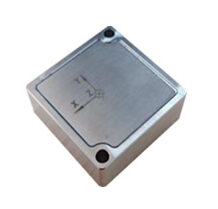
At the center of many integrated navigation architectures is the INS (Inertial Navigation System). Unlike navigation technologies that rely on external signals, INS determines vehicle motion by measuring acceleration and angular changes through inertial sensors. It can independently provide attitude, velocity, and position information, making it the core component responsible for continuous navigation.
However, maintaining high INS accuracy over long operating periods remains a major engineering challenge. Since INS calculates position through the integration of inertial measurements, small sensor errors can gradually accumulate and cause navigation drift. Therefore, improving sensor performance, calibration methods, and error compensation strategies is essential for building a reliable navigation system.
For Andelu, we focus on developing INS solutions that provide stable inertial measurement and reliable navigation performance for demanding applications. Our goal is to help engineers build integrated navigation systems with better accuracy, continuity, and adaptability.
How INS Works in an Integrated Navigation System
INS Measurement and Navigation Data Processing
An INS mainly relies on an inertial measurement unit (IMU), which includes gyroscopes and accelerometers. The gyroscopes measure angular motion to calculate attitude changes, while accelerometers measure specific force to estimate velocity and position.
The navigation calculation process typically includes three key stages: attitude updating, velocity updating, and position updating. First, the INS determines the orientation of the vehicle coordinate system through gyroscope measurements. Then, acceleration information is transformed into the navigation coordinate system to calculate velocity changes. Finally, velocity is integrated to obtain position information.
This continuous calculation capability allows INS to provide real-time navigation outputs without depending on external signals. According to vehicle navigation research, a strapdown inertial navigation system (SINS) can serve as the main navigation reference because of its autonomy and strong resistance to external interference.
However, the accuracy of INS depends heavily on the stability of inertial sensors. Bias errors, scale factor errors, and measurement noise from gyroscopes and accelerometers can affect navigation results. Because these errors are repeatedly integrated during the navigation process, even small inaccuracies can become significant over time.
Why INS Accuracy Determines Navigation Continuity
The most important advantage of INS is its ability to maintain continuous navigation when external positioning signals are unavailable. This capability is especially valuable in environments such as urban areas, tunnels, forests, or other locations where satellite signals may become unstable.
In vehicle applications, GNSS signals can be affected by environmental conditions and may experience interruption. During these periods, INS continues providing motion information and prevents sudden loss of navigation output. Research on GNSS/INS vehicle navigation systems shows that INS plays a critical role in maintaining navigation continuity during GNSS signal outages.
For this reason, improving INS accuracy is not only about achieving better positioning results. It is also about ensuring that the navigation system remains reliable when external information becomes limited.
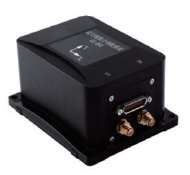
Improving INS Performance Through Error Compensation
Understanding INS Error Sources
A high-performance INS requires accurate modeling and compensation of different error sources. Common inertial errors include gyroscope bias, accelerometer bias, sensor noise, and installation-related errors.
Gyroscope errors directly influence attitude calculation. Since attitude information is used in velocity and position calculations, small attitude deviations can gradually affect the final navigation solution. Similarly, accelerometer bias introduces velocity errors that continue increasing during integration.
Vehicle-mounted INS systems face additional challenges because vehicles operate under vibration, acceleration changes, temperature variations, and complex motion conditions. These factors make calibration and compensation strategies essential for maintaining stable INS performance.
The uploaded vehicle navigation research highlights that inertial navigation accuracy is closely related to sensor errors, installation deviations, and compensation algorithms. Proper modeling of these error sources allows the navigation system to estimate and correct deviations during operation.
The Importance of INS Calibration and Installation Accuracy
Calibration is a key process for improving INS accuracy. Before deployment, engineers need to identify sensor characteristics and compensate for errors caused by manufacturing variation and environmental conditions.
Installation accuracy is another important factor. In real vehicle applications, the INS is mounted on the vehicle structure, and small alignment errors between the INS coordinate system and vehicle coordinate system can affect navigation results.
When an INS is integrated with other sensors, the relative position difference between measurement units must also be considered. For example, the offset between a GNSS antenna and the INS center creates a lever-arm effect. If this offset is ignored, vehicle movement may introduce additional position and attitude errors.
Vehicle navigation studies have shown that installation errors and sensor alignment must be considered in integrated navigation models to improve system accuracy.
GNSS/INS Integration: Supporting INS With External Corrections
The Role of GNSS in INS-Based Navigation
Although INS is the core navigation source, external correction information can significantly improve long-term accuracy. In a GNSS/INS integrated navigation system, GNSS mainly provides position references to help estimate and compensate INS accumulated errors.
The relationship between GNSS and INS is complementary rather than competitive. GNSS provides stable absolute positioning information but depends on signal availability. INS provides continuous motion estimation but experiences error growth over time.
By combining these two technologies, the system can maintain continuous navigation while improving long-term accuracy. INS continues operating between GNSS updates, while GNSS measurements help correct INS drift.
Sensor Fusion Algorithms for Better INS Accuracy
The performance of GNSS/INS integration depends largely on the fusion algorithm. Kalman filtering is widely used because it can estimate navigation errors and combine information from different sensors.
In a typical integrated navigation system, INS provides prediction results, while external sensors provide correction measurements. The filter estimates errors such as position deviation, velocity error, attitude error, and inertial sensor bias, then applies corrections to improve navigation performance.
For vehicle navigation systems, additional information such as odometers and vehicle motion constraints can further support INS performance. Studies show that motion constraints can effectively suppress INS error growth, especially when GNSS signals are interrupted.
Designing Reliable INS Solutions for Future Navigation Applications
The future of navigation technology requires systems that can operate accurately in increasingly complex environments. While external positioning technologies remain useful, INS continues to be the foundation that provides continuous motion awareness.
At Andelu, we design INS solutions with a focus on accuracy, stability, and integration flexibility. By combining advanced inertial sensing technology with calibration and compensation methods, our products support engineers in developing reliable integrated navigation systems for demanding applications.
A strong INS architecture enables navigation systems to maintain performance even when external signals are limited. Whether used in vehicle navigation, industrial automation, or autonomous platforms, improving INS accuracy is the key to achieving reliable and continuous navigation.
Preguntas frecuentes
Q: What is the role of INS in an integrated navigation system?
A: INS provides continuous attitude, velocity, and position information based on inertial measurements. It serves as the primary navigation source and maintains operation without external signals.
Q: Why does INS require calibration?
A: Calibration helps reduce sensor errors such as bias, scale factor errors, and alignment deviations, improving long-term navigation accuracy.
Q: How does GNSS improve INS performance?
A: GNSS provides external position references that help correct INS drift and improve long-term navigation accuracy.
Q: Can INS operate without GNSS?
A: Yes. INS can operate independently, but navigation errors gradually increase because of inertial sensor errors. External correction sources are often used for high-accuracy long-duration applications.